Mountains and First World War
Monte Novegno -First World War Ecomuseum
DETAILS
LENGTH
DIFFICULTY
DIFFERENCE
- Desk
- walks
- Routes
- History
- great war
Description
FROM BUSA NOVEGNO TO RIVON THROUGH CIMA ALTA
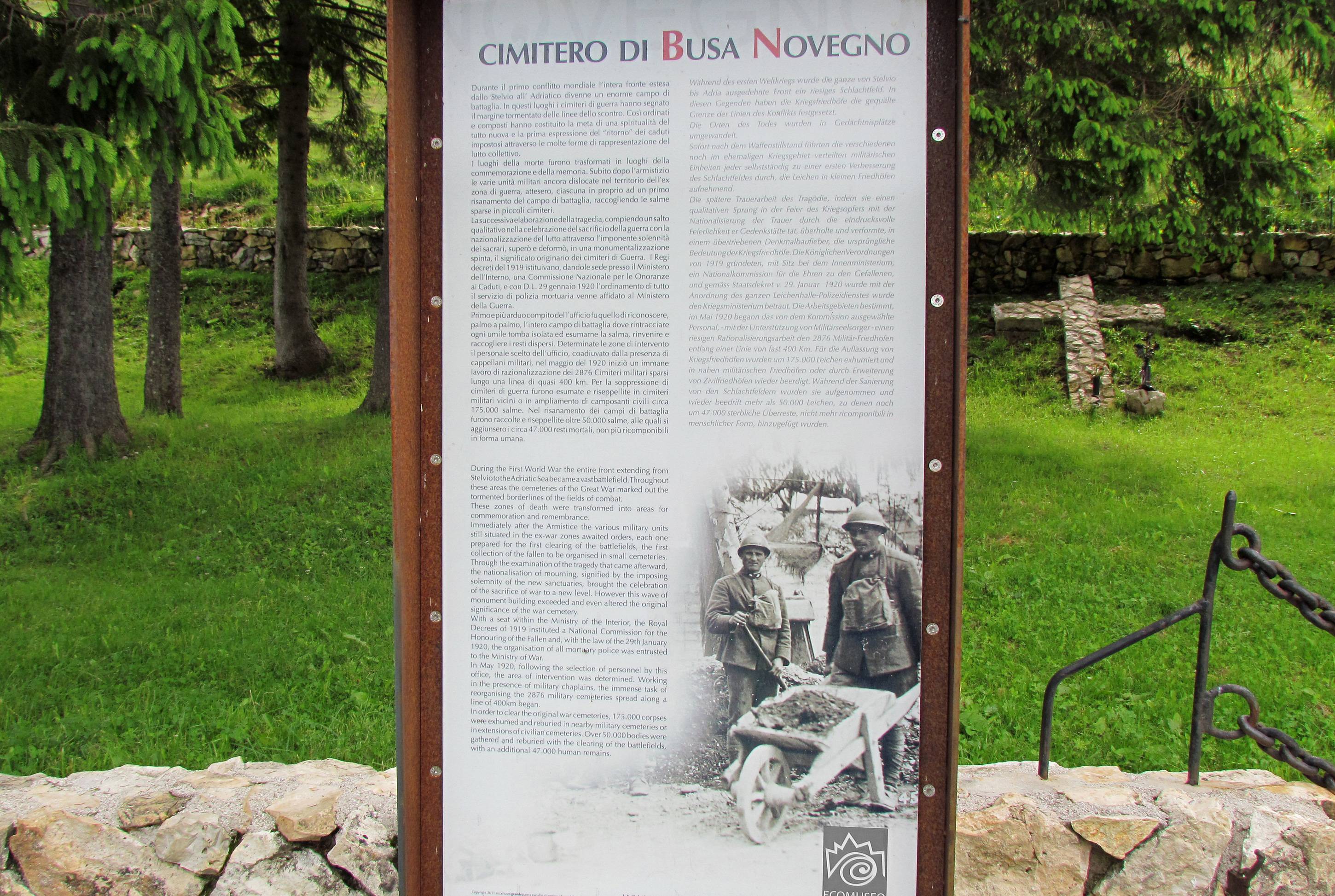
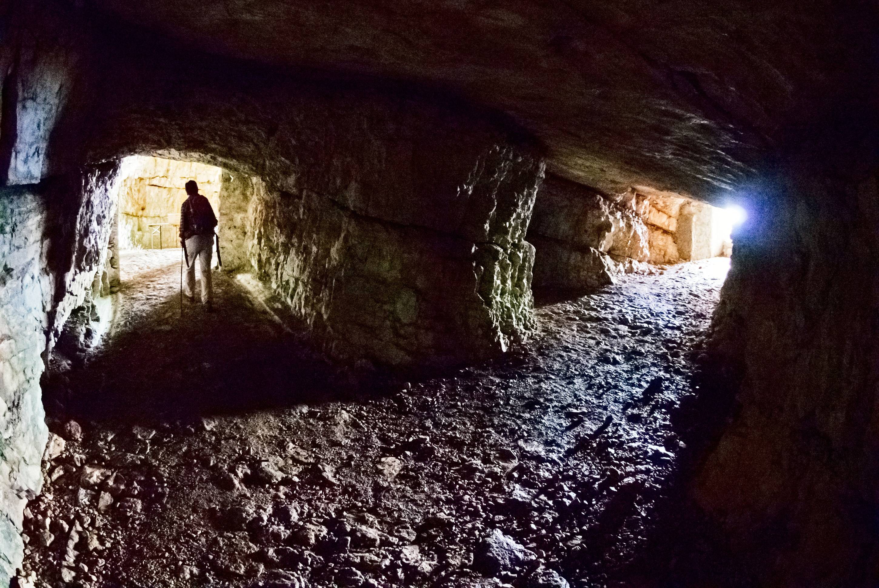
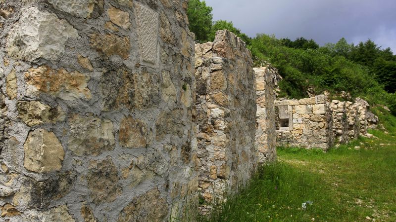
After having parked the car and having reached "busa del monte Novegno", in the vicinity of Pozza Lunga, turn right on the unpaved street. When you overcome the military cimintery and you reach the crossroad, turn right again and proceed until you get to the recovered military road, on the left. Then, take the path to Cima Alta. Almost at the end of the climb go along the semicircular trench you find on the right, which leads to a cave. Inside the cave you will find a simple iron stepladder which brings back at the beginning of the trench. If you continue climbing, you will find a large gallery which leads to a really interesting trench which il placed around the peak. The view you will be able to admire makes it clear how important this fortified belt was. By following the summit ridge you will see some circular buildings: they are nests for antiaircraft machine gun. Frontally there is the surrounding view towards Priaforà and Monte Ciove, essential areas during the offensive in 1916. Follow the signage carefully, first in the undergrowth and then downhill, you will cross grassy clearings. When you arrive at the end of the downhill from Cima Alta, once passed over the grid and after a short path, you will reach "passo Vaccarezze".
On the right, follow the street that leads to the great fortification. Once crossed the open space, follow the directions, so turn left and go down along the path until reaching the entrance of the great gallery; there you will find a concrete staircase which leads to the fotification's floors.
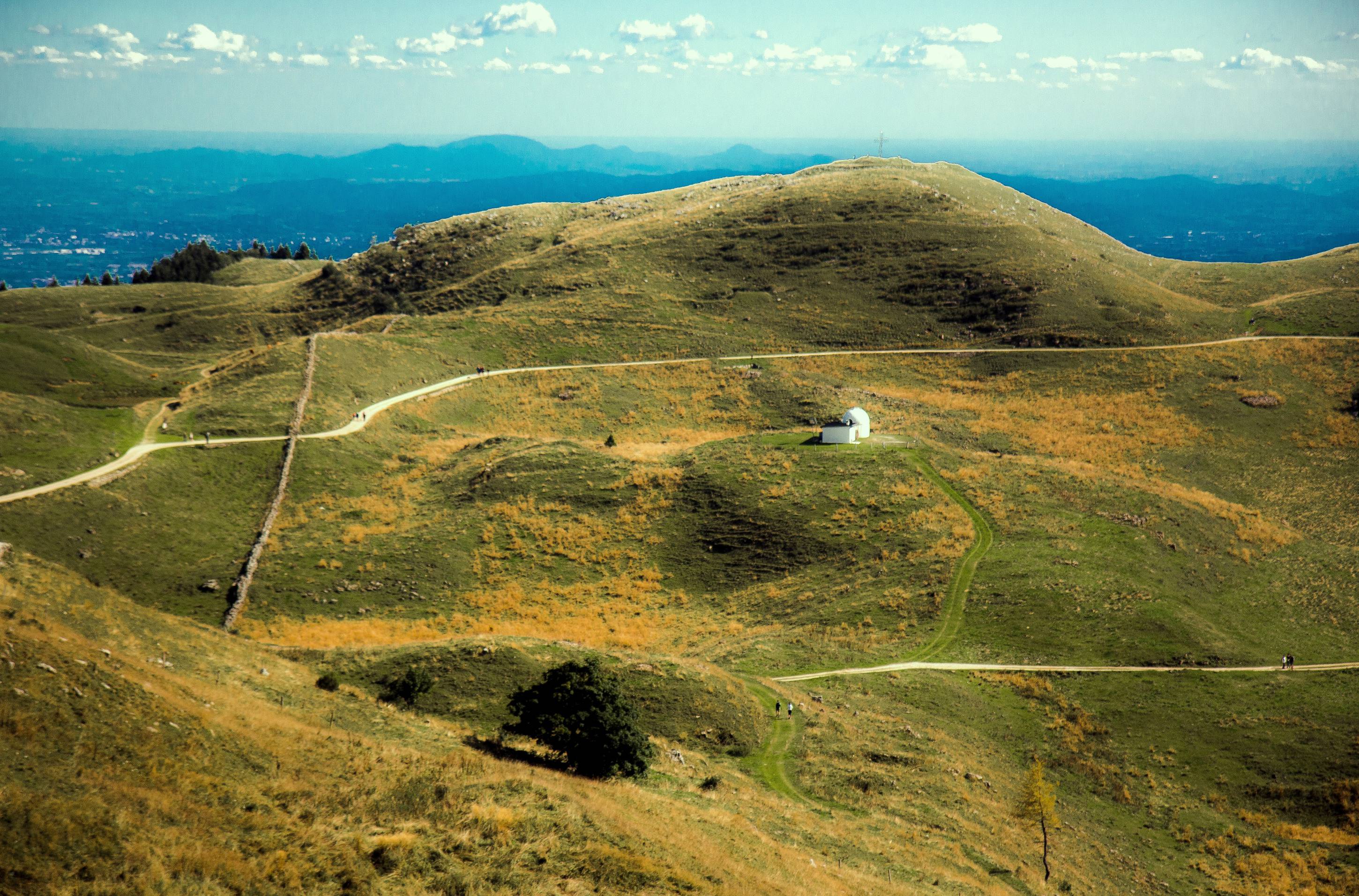
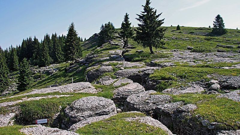
Outside the fortification, go along the trench, which is very well preserved, until you reach l'osservatorio (observatory) delle Vaccarezze, which offers an emotional view over Monte Pasubio and Val Posina.
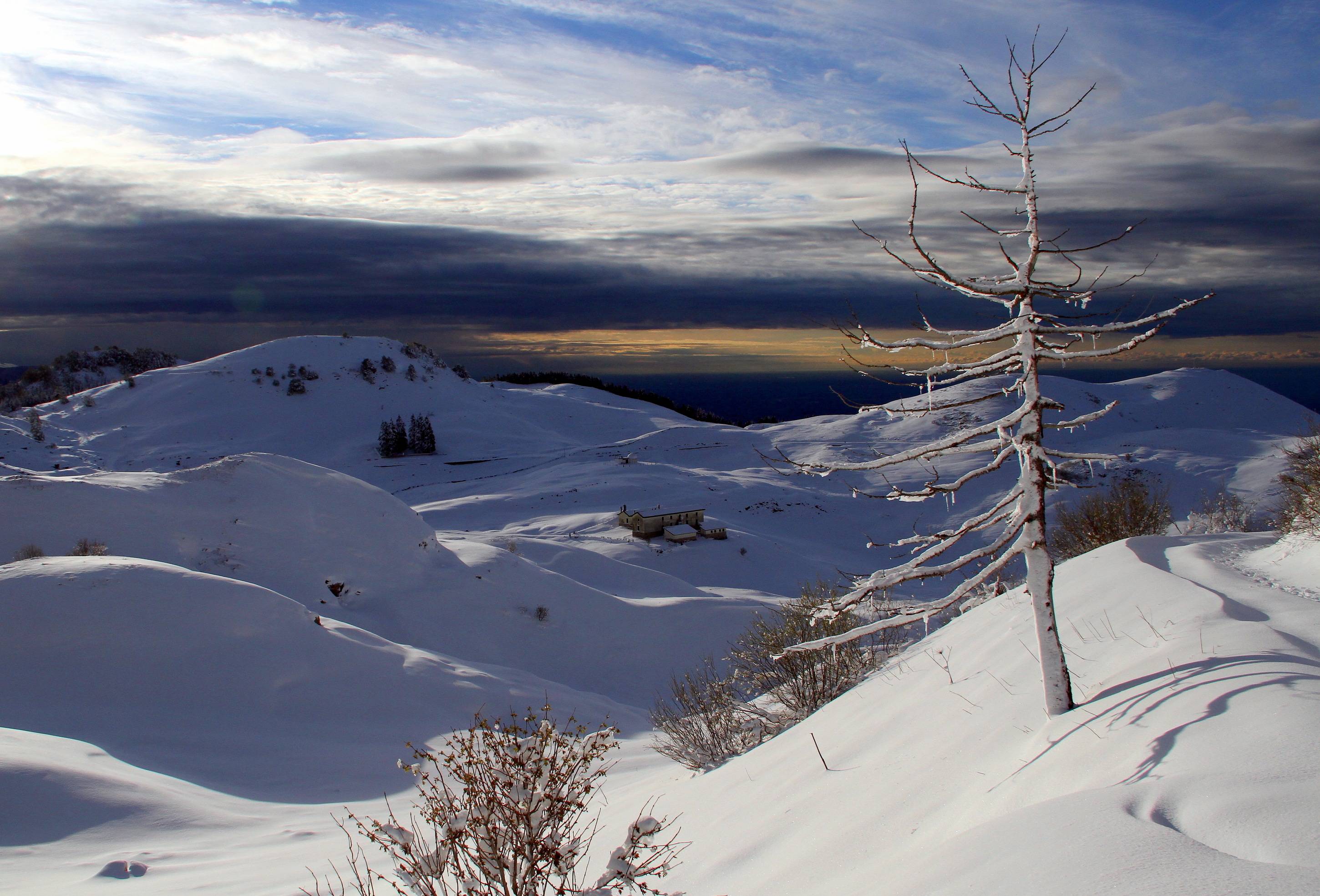
Turn back straight on along the trench and you will recover the street which leads to passo delle Vaccarezze. From now on, by crossing the mule track on the right, you will admire malga Novegno below, surrounded by pastures and water holes. Once reached the crossroad, keep climbing on the right along the route to Forte Rivon.
Gallery
Related
Nearby
Alloggio Turistico e Ristorante Vegetariano Damarco
EVENT IN EVIDENCE
Musica
Graal
Rito sonoro e visione con i musicisti Vincenzo Zitello e Fulvio Renzi, presso Agr. Il Maggiociondolo. Evento facente parte della...
Start: 08 Aug 18:00
End at: 08 Aug 19:30